Alberta runs on Rogers, Bell and Telus, and your eSIM rides one of them as its host. Coverage is strong in Calgary and Edmonton, decent along the main highways, and absent across most of the terrain people actually come here for. Our Vancouver, Toronto and Montreal guides cover Canadian city connectivity and transit payments. This one is about the other Canada - a province where the interesting parts have no signal, the weather can turn in an hour, and one recent summer burned a third of a town down.
This is the honest headline for anyone visiting the Rockies between roughly May and September.
Jasper burned in July 2024. A lightning-started fire, driven by drought, reached the townsite on 22 July and destroyed 358 of its 1,113 structures - about a third of the town - after residents and visitors were evacuated. It burned over 32,000 hectares and was the largest fire in the park in a century.
Jasper is open and rebuilding. Permits are moving, construction is underway, and substantial federal funding was committed in 2026. Visitors are welcomed and the town needs them.
And 97% of Jasper National Park is intact. The Icefields Parkway, the Columbia Icefield, Maligne Canyon and the great majority of the park were untouched. What you will see is a burn scar around the townsite and along parts of the valley, which is sobering rather than disappointing.
Smoke is the wider issue. Even when fires are hundreds of kilometres away - in British Columbia or northern Alberta - smoke can settle over the Rockies for days, turning the mountains into a grey outline and making air quality genuinely poor. This is the most common way a wildfire season affects a trip.
Alberta Emergency Alert reaches your phone. Wireless public alerting broadcasts to handsets on an Alberta network, roaming foreign ones included, and it is used for evacuation orders. It is loud and it overrides silent mode. Leave emergency alerts enabled - this is the one place in this series where an alert may be telling you to leave.
Check conditions before you drive. Parks Canada and the Alberta wildfire service publish current closures, and highways including the Parkway have been closed at short notice.
Calgary and Edmonton are well covered. So is the Trans-Canada corridor through Banff, and the townsites of Banff, Canmore, Jasper and Lake Louise.
The Icefields Parkway is the famous gap. The 230 km between Lake Louise and Jasper is one of the great drives in the world and has long stretches with no coverage at all. There is no fuel for most of it either, and the one station at Saskatchewan River Crossing has limited hours.
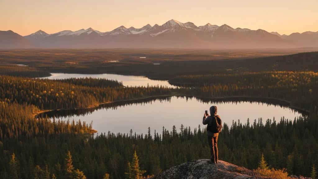
Trails have nothing. Once you are off the road you are off the network - Larch Valley, the Plain of Six Glaciers, Sulphur Skyline, all of it.
The Columbia Icefield has service around the Discovery Centre and none on the glacier.
Kananaskis Country, the mountain area closest to Calgary, is patchy to absent in the valleys.
The badlands around Drumheller are covered in town and thin in the coulees.
So download everything. Offline maps for the whole route, your accommodation details, your park pass. And tell someone your plan, because a phone is not a safety device on these trails.
Not a connectivity matter, but the thing visitors most often get wrong.
Both black and grizzly bears live throughout the mountain parks, and encounters on trails are routine rather than exotic.
Carry bear spray and know how to use it. It is sold and rented in every mountain town, and it cannot go in aircraft hold or cabin baggage, so buy or hire it here.
Make noise on the trail. Most bad encounters are surprises. Talking loudly on blind corners is the single most effective thing you can do, and it is why you will hear people calling out.
Never leave food in a vehicle at a trailhead, and use the bear-proof bins provided.
Trail closures are posted and enforced when a bear is active in an area, and some trails require groups of four or more in season. These are legal requirements, not advice.
Elk are more dangerous than they look, particularly in autumn rut and spring calving, and they wander through Banff and Jasper townsites.
You need a Parks Canada pass for Banff, Jasper and the other national parks - a day pass or an annual Discovery Pass, bought online or at the gate.
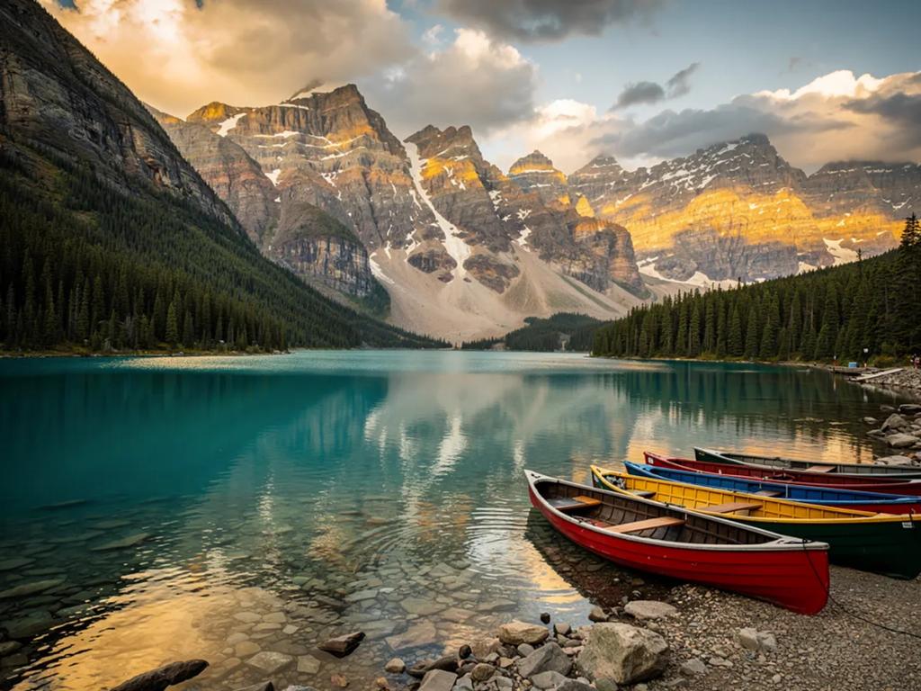
Moraine Lake is no longer reachable by private car. The access road has been closed to personal vehicles, with shuttles, buses and commercial operators the only way in, and it books up. This is the single most common frustration for people who arrived expecting to drive up at dawn.
Lake Louise parking fills before sunrise in summer, and there are shuttle systems for it too.
Book the shuttles well ahead, and check the current arrangements before travelling - Parks Canada has adjusted this system repeatedly.
Distances are Canadian. Calgary to Banff is 90 minutes; Banff to Jasper is four hours before you stop for anything, and you will stop constantly.
- Parks Canada, for passes, shuttles, closures and trail conditions.
- Alberta Wildfire and AlbertaFireBans, in season.
- Maps with offline copies of the entire route, downloaded before you leave the cities.
- 511 Alberta for road conditions and highway closures, which matter in both fire and snow season.
- A weather app that does mountain forecasts rather than city ones.
- Uber and Lyft operate in Calgary and Edmonton, and essentially not in the parks - you need a car.
Calgary International (YYC) is the main gateway, with the best international connections and a 90-minute drive to Banff.
Edmonton International (YEG) is the alternative and closer to Jasper, about four hours.
Hire a car. There is a bus service between Calgary, Banff and Lake Louise, and a rail service, but the parks are effectively a driving destination and the Icefields Parkway in particular is the point.
Canada is a separate roaming zone from the US - if you are combining the two, check that your plan covers both, because North America bundles vary and Canadian roaming is expensive without one.
Less than you would expect in absolute terms, because you spend so much of the trip without service. What matters is offline preparation rather than allowance: maps, park documents and accommodation details downloaded before you leave the city. Budget enough for the days at either end when you are in Calgary or Edmonton and actually online.
Layers, and a genuine warm layer even in July. Mountain nights drop close to freezing in midsummer.
Waterproof shell. Weather turns fast at altitude.
Proper hiking boots for anything beyond a lakeshore path.
Sun protection. High altitude, thin air, and snow reflection well into summer.
Serious winter kit from November to March - this is a cold-climate province and -25C is an ordinary January day.
Nothing formal is needed anywhere, including Calgary, which dresses down and wears boots to the Stampede on purpose.
Moraine Lake at sunrise, with the Valley of the Ten Peaks behind - the shot that was on the old twenty-dollar note. Book the shuttle.
Lake Louise with the Victoria Glacier, from the lakeshore path.
Peyto Lake from the Bow Summit viewpoint on the Icefields Parkway, the wolf-head-shaped lake in improbable blue.
The Icefields Parkway itself, which is the drive rather than a single view.
Athabasca Falls and Maligne Canyon, both near Jasper.
Spirit Island on Maligne Lake, reachable only by boat.
The Royal Tyrrell Museum's badlands at Drumheller, which look like Mars and hold one of the world's great dinosaur collections.
The Banff Gondola at Sulphur Mountain for the valley from above.
Banff was Canada's first national park, established in 1885 after railway workers found hot springs on Sulphur Mountain.
The lakes are that colour because of rock flour. Glaciers grind bedrock into a powder so fine it stays suspended in the meltwater and scatters blue-green light. It is not a filter and it changes through the season as the melt does.
Alberta's badlands are among the richest dinosaur fossil beds on earth. Dinosaur Provincial Park is UNESCO-listed, and the Royal Tyrrell holds tens of thousands of specimens.
Chinook winds can raise the temperature in southern Alberta by 15 or 20 degrees in a few hours - Calgary can go from deep freeze to shirtsleeves over a lunchtime.
The Columbia Icefield feeds three oceans. Meltwater from it reaches the Pacific, the Arctic and, via Hudson Bay, the Atlantic - one of very few hydrological apexes in the world.
And the Calgary Stampede calls itself the greatest outdoor show on earth, and for ten days in July the whole city genuinely dresses for it.
The Calgary Stampede, ten days in July - rodeo, chuckwagons, concerts and a city in cowboy hats. Accommodation prices double.
The Banff Centre Mountain Film Festival, in late October and November, which then tours the world.
Ski season, roughly November to May, across Lake Louise, Sunshine Village, Norquay and Marmot Basin.
Summer, June to September, is peak for the parks, and July and August are genuinely crowded at the famous lakes.
September is the sweet spot: larches turning gold, thinner crowds, and usually past the worst of the fire season.
The love: the Canadian Rockies are among the most spectacular accessible mountain landscapes on the planet, and Alberta holds the best of them. The Icefields Parkway is a genuinely world-class drive, the lake colours are not exaggerated, wildlife is abundant and visible, and the infrastructure - roads, trails, campgrounds, interpretation - is excellent. Calgary and Edmonton are comfortable, friendly bases with good food, and the badlands are a completely different landscape two hours east.
The complaints are consistent. It is crowded at Lake Louise, Moraine and Banff townsite in summer, to the point of shuttles and reservation systems. It is expensive, particularly accommodation in the parks. You need a car and will drive long distances. Wildfire smoke can grey out the whole reason you came, sometimes for a week. The season is short - many trails hold snow into July. And visitors expecting wilderness solitude find a well-managed, heavily visited national park system, which is exactly what protects it.
Come in September, book Moraine Lake transport before anything else, download your maps in Calgary, and carry bear spray.
Largely not. The 230 km between Lake Louise and Jasper has long stretches with no coverage, and no fuel for most of it either. Download offline maps for the whole route before leaving Lake Louise, fill the tank, and do not plan to be reachable during the drive.
Alberta Emergency Alert uses wireless public alerting, which reaches handsets on an Alberta network including roaming foreign ones. In summer it most often means a wildfire evacuation order. It overrides silent mode by design. Leave emergency alerts enabled - this is a province where the alert may genuinely be telling you to leave.
Yes. The fire destroyed about a third of the townsite's structures in July 2024 and the town is rebuilding, but 97% of the national park is intact - the Icefields Parkway, the Columbia Icefield and Maligne Canyon were untouched. You will see burn scars near the town, and visitors are needed.
Yes, more than people expect. You need a Parks Canada pass, and Moraine Lake can no longer be reached by private vehicle - shuttles and commercial operators only, and they sell out. Lake Louise parking fills before dawn in summer. Check the current arrangements with Parks Canada before travelling; the system has changed repeatedly.