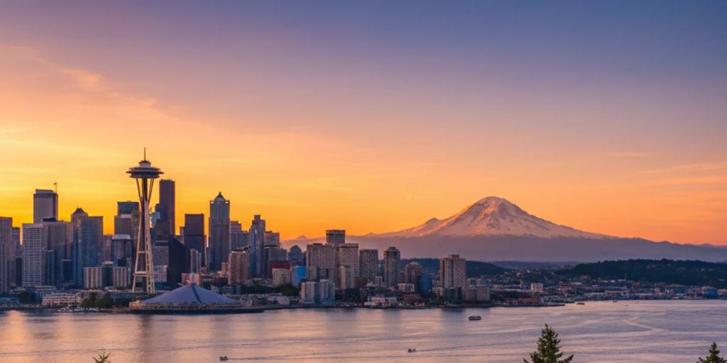
Seattle might be the easiest connectivity stop in America - this is T-Mobile's hometown (headquarters sit in Bellevue, across the lake), and all three US networks - T-Mobile, Verizon and AT&T - run dense 4G and 5G across the metro. Your eSIM rides one of them as its host network, and in practice that means fast data everywhere a visitor goes: downtown, Pike Place, Capitol Hill, Fremont, the stadiums, and out on the water of Elliott Bay, where the skyline-from-the-ferry photo uploads without complaint.
Inside the city, almost nowhere - the honest exceptions are the day trips. Seattle sits an hour or two from some of the most spectacular and least-covered terrain in the country: the Olympic Peninsula, Mount Rainier National Park, and the Cascade mountain passes all have long stretches with no signal on any network. If you are renting a car for Rainier or the Hoh Rainforest, download offline maps before you leave the city, not at the trailhead - the car park is usually too late. In town, the light rail's deep downtown tunnel stations have coverage, but data on a moving train between them can stutter, so load anything you need before the doors close.
- Tap-to-pay works on transit now: since February 2026, ORCA's Tap to Pay lets you tap a contactless credit card, phone or watch directly at Link light rail readers, on buses and the streetcar - no ORCA card errand required. One tap covers a two-hour transfer window; each rider needs their own card or device.
- The Transit or One Bus Away apps give live arrivals - Seattle's buses are how locals actually cross the hilly neighbourhoods, and real-time tracking needs data constantly.
- The WSDOT app and Washington State Ferries alerts matter if you do the classic move: walk on to the Bainbridge Island ferry at Colman Dock for the best cheap skyline cruise in the city. Check sailing times and terminal alerts in-app.
- Uber and Lyft both operate everywhere, and Lime scooters and bikes handle the last mile - all app-only.
- Trail apps run this town: if you day-hike (and Seattle will tempt you), locals live by offline-capable trail maps. Download the route on hotel Wi-Fi; the trailheads mostly have zero bars.
From SeaTac airport, the Link 1 Line runs from the airport station straight into downtown in about 40 minutes, and with Tap to Pay you just touch your card or phone at the reader on the platform. Ride apps pick up on the third floor of the parking garage. Either way, the ride in is exactly when the landing texts, hotel directions and first map searches hit your plan - installing the eSIM before you fly beats fighting airport Wi-Fi at baggage claim.
A Seattle trip is moderate on maps, heavy on photos (the water-and-mountains backdrop does that), and heavy on transit apps. For most travellers 1GB per 2-3 days covers navigation, messaging and posting; budget extra if you are uploading ferry videos or streaming a Mariners game on the move. Top-ups are a dashboard tap away. For the network-level detail, our USA eSIM guide covers coverage and plan choices, and the T-Mobile vs Verizon vs AT&T comparison breaks down the host networks - useful trivia in the city where one of them was born.
The local uniform is a fleece plus a rain shell, and it exists for a reason: the rain here is a fine drizzle that comes and goes all day, and umbrellas genuinely mark you as a tourist - locals just put a hood up and keep walking. Pack layers year-round: ferry decks are windy even in July, and summer evenings drop cool enough that a warm hat is not a silly thing to bring. Winter needs waterproof shoes more than a heavy coat.
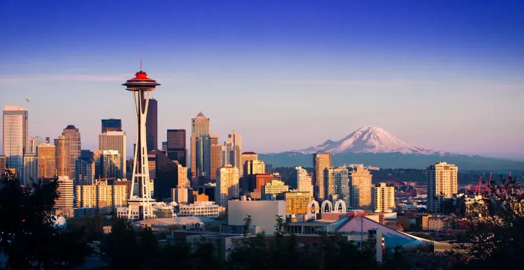
Kerry Park on Queen Anne hill is THE Seattle shot - the Space Needle against the skyline with Mount Rainier floating behind it on a clear day. Go at sunset and stand at the railing; the alignment does the work. At Pike Place Market, the fishmongers really do throw the fish - hang around the main stall a few minutes and you will catch a toss. The Gum Wall in Post Alley just below the market is gross and great, best shot from a few steps back to get the full technicolor wall. And take the Bainbridge ferry at golden hour: shoot the skyline receding from the stern deck.
After the Great Seattle Fire of 1889, the city rebuilt Pioneer Square one story higher - the original street level still exists underneath, and the Underground Tour walks you through it. The Space Needle was built for the 1962 World's Fair in roughly 400 days, earning it the nickname "the 400-day wonder." Boeing and Starbucks were born here, Amazon grew up here, and Microsoft sits just across the lake in Redmond. And "the mountain is out" is genuine local vocabulary - it means Rainier is visible, and yes, people say it out loud.
Seafair stretches across late July and early August, peaking with the Blue Angels air show and hydroplane races over Lake Washington (July 31 to August 2 in 2026). Bumbershoot, the arts and music festival at Seattle Center, is back and runs Labor Day weekend (September 5-6 in 2026). The Fremont Solstice Parade in mid-June is Seattle at its weirdest, famously featuring body-painted cyclists. And game days at Lumen Field (Seahawks, Sounders) and T-Mobile Park (Mariners) take over the whole stadium district.
The love is real: water and mountains visible from ordinary street corners, coffee standards that ruin you for other cities, and a July-to-September stretch of dry, golden, 25C perfection that locals guard like a secret. The gripes are real too. The grey season is genuinely long - October through May of low cloud and drizzle wears on visitors and residents alike. Prices climbed hard with the tech boom, and hotels and restaurants show it. Parts of the city centre core still feel emptier and rougher than the postcard suggests, and traffic across the two floating bridges to the Eastside can turn a 15-minute hop into an hour.
Yes. Since February 2026, ORCA Tap to Pay accepts contactless credit and debit cards, Apple Pay, Google Pay and Samsung Pay directly at Link readers, buses and the streetcar. You are charged the standard adult fare and get a two-hour transfer window; each rider taps their own card or device.
Mostly no, on any network. The national parks and mountain passes around Seattle have long dead zones, so download offline maps and your trail route in the city before you drive out. In Seattle itself coverage is excellent - the gap only opens once you leave the metro.
Depends how you feel about the fine print: the famous store at 1912 Pike Place is the oldest surviving Starbucks, but not the literal first - the original 1971 location stood nearby and later moved. The coffee inside is the same as any branch, so many visitors photograph the sign, skip the line, and spend the time at the market's fish stall instead.